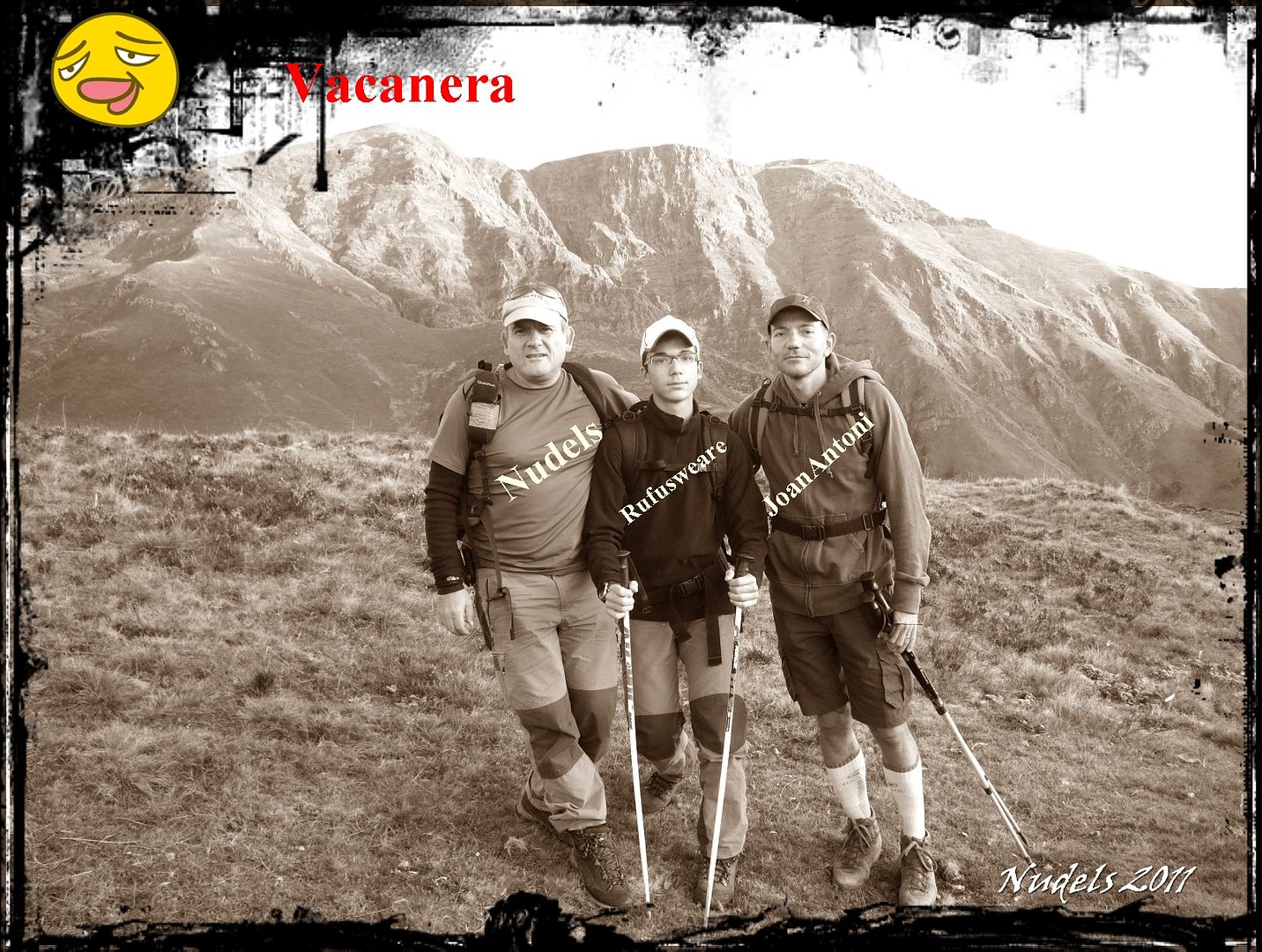
Esta bonita ruta que tenemos que localizar la parte baja de la Val d'Aran desde la población de Bausén nos desplazamos con vehículo 4x4 por una pista forestal que sale del pueblo hacia el W., después de unos kilómetros tomamos un desvío a la izquierda y recorremos cerca de 7 km., por otra exigente pista con mucho desnivel hasta llegar al final donde estacionamos el vehículo. Nuestro objetivo es el Tuc deth Plan deth Home (2.194 m.)esta montaña también es conocida como el Tuc de Vacanera/Bacanera y suele estar más visitada por la parte francesa porque cuenta con mejores accesos y hasta allí llega el importante GR-10. Nosotros no quisimos subir desde el pueblo de Bausén andando porque queríamos recorrer el cordal fronterizo subiendo a cuantas montañas nos fuera posible y nos llevaría demasiado tiempo, así queda pendiente una subida directa desde Bausén al Tuc deth Plan deth Home o Tuc de Vacanera.
Casi todos los nombres están copiados de los mapas del ICC (Instituto Cartográfico de Cataluña).
Casi todos los nombres están copiados de los mapas del ICC (Instituto Cartográfico de Cataluña).
OBSERVACIONES Y CURIOSIDADES :
Mejor llevar el agua para todo el trayecto.
Telefonía móvil: Con poca cobertura Movistar.
Fotografía: Instantáneas capturadas con una cámara digital Fujilm 100.
La actividad también está publicado en el blog Montañas y Mugas.
La actividad también está publicado en el blog Montañas y Mugas.
DATOS TÉCNICOS: REFERENCIA:Mapa excursionista: Alpina Val d’Aran. Escala 1:25.000
Actividad: Senderismo cerca de Bausén, Catalunya(España)
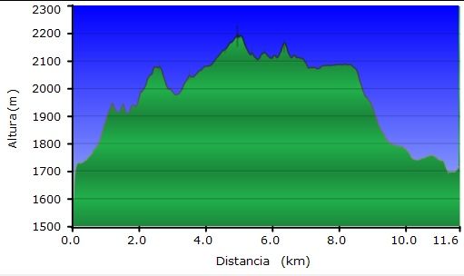
Distancia recorrida: 11,61 kilómetros
Altitud min: 1.599 metros, max: 2.192 metros
Desnivel acum. subiendo: 824 metros, bajando: 761 metros
Grado de dificultad: Fácil
Tiempo: 4 horas 40 minutos
Fecha: 1 de octubre de 2011
Finaliza en el punto de partida (circular): Sí
El track
© nudels Tots els drets reservats
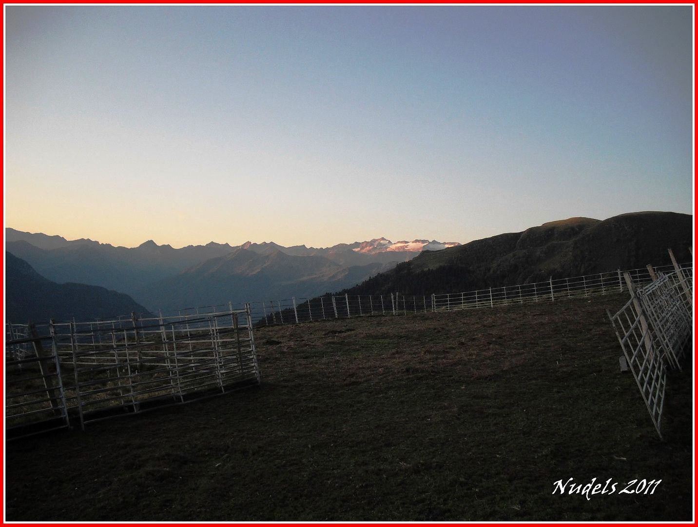
07h58: Para llegar a este lugar hemos utilizado un 4x4, saliendo de Bausen hacia el W., tomando una pista forestal con tramos de exagerada pendiente. Poco ganado queda ya, al fondo la Maladetas.
07h58: Nos preparamos para la actividad de hoy, pero antes nos vamos a presentar...
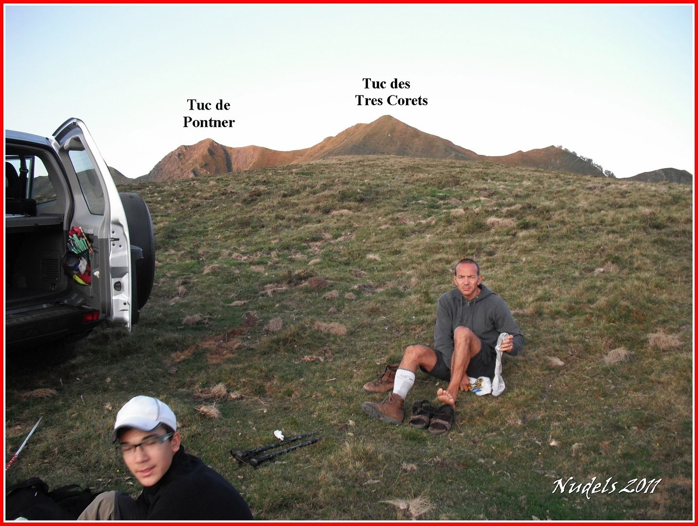
08h03: Nuestro objetivo principal es el Tuc deth Plan deth Home o Tuc de Vacanera pero también subiremos todas las montañas que encontremos en el camino y por supuesto también cazaremos todas las mugas porque nuestra actividad transcurre por el cordal fronterizo.
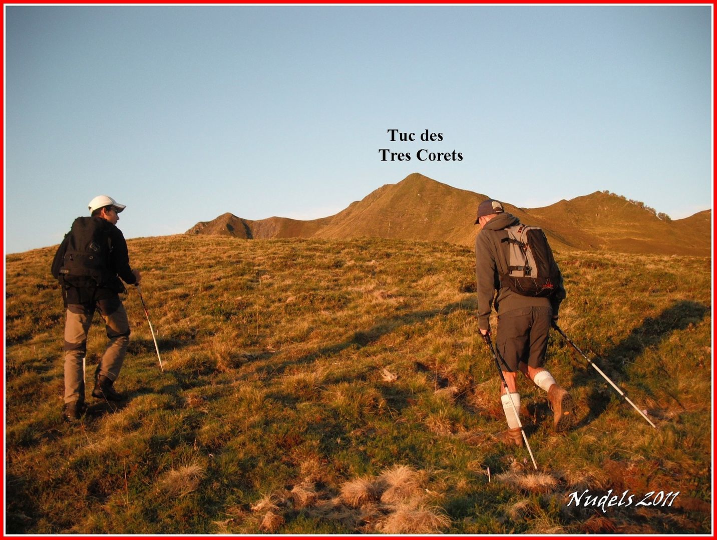
08h04: Empezamos con una corta marcha al Tuc des Tres Corets.
08h19: En su inicio lo abordamos por la cresta.
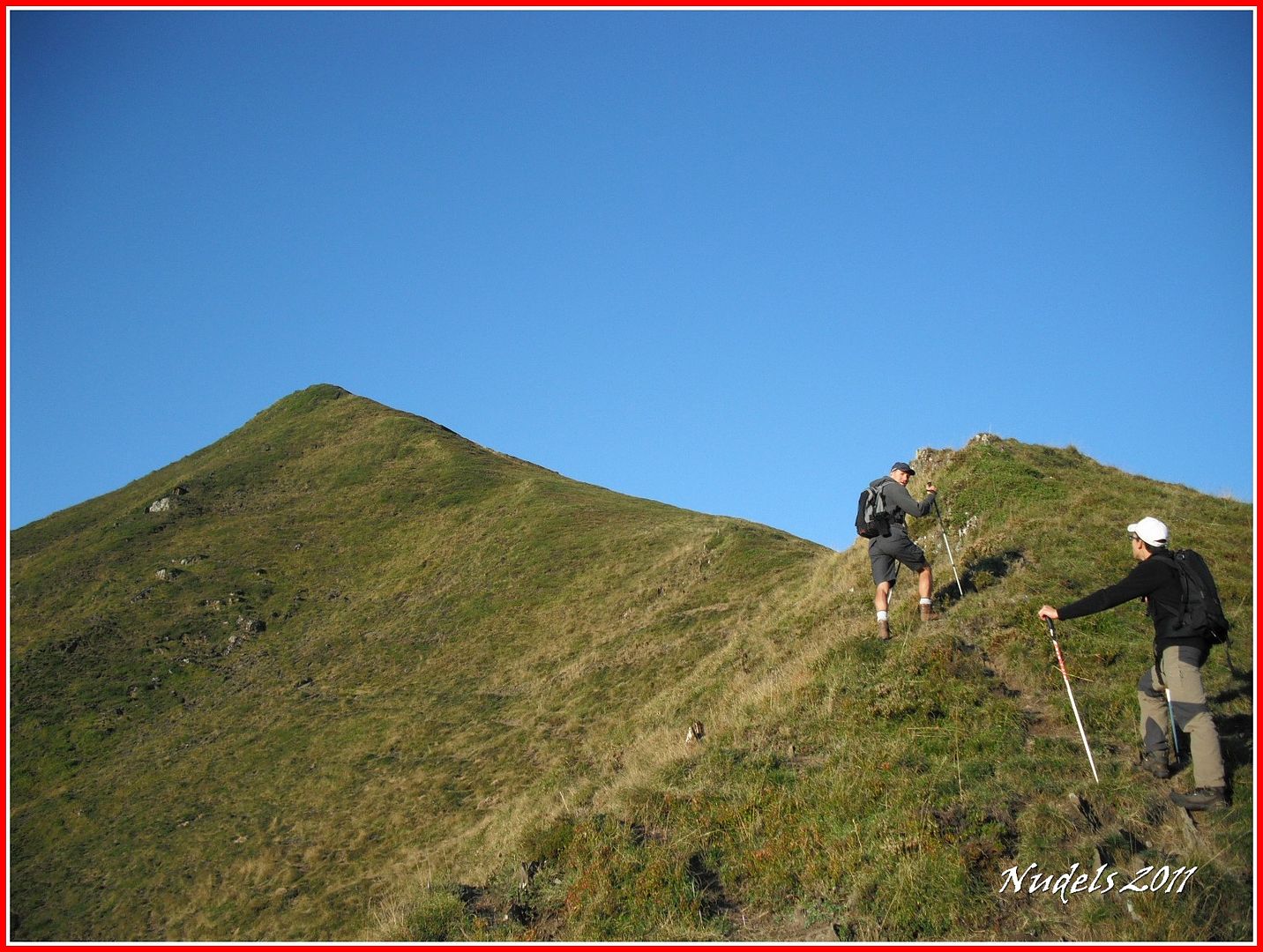
08h19: Una mirada atrás.
08h31: Y llegamos a la cima.

08h32: En la cima está la muga 391.

08h32: La parte francesa nos presenta unas vistas espectaculares.

08h33: Pero antes nos tomamos un respiro y lo celebramos porque estamos en lo más alto del Tuc de Tres Corets (1.947 m.).

08h34:

08h32: Por ahí seguiremos...

08h36:

08h36: Lo que dejamos a nuestra espalda.

08h36: Y ahora identificamos con letreritos el lugar de partida.

08h45: Continuamos la marcha y llegamos a lo más alto del Turón de Bedurat o Malh des Bessons (1.944 m.).

08h45: Joan Antoni y Marc en el papel de "figurantes".

08h45: El Tuc de Vacanera.

08h46: De nuevo la parte francesa.

08h53: Pido a los figurantes que se metan más en su papel y así lo hicieron, llegamos a la muga 393.

08h59: Y unos minutos más tarde a la muga 394.

09h00: Otra mirada a la lejanía.

09h01: El lugar tiene una vistas excelentes. Ehhh, chicos tenemos que seguir.

09h01: Así está mejor.

09h13: Tenemos unas espectador@s de lujo.

09h13: Muga 355, este mojón está inclinado y escenificamos.

09h14: Estamos en lo má salto del Cap deth Còth d'Estanhs (2.083 m.).

09h17: Llegamos a la muga 396.

09h18: Y nos siguiente quedando bastante trecho.

09h19: Vamos perdiendo altura para después volver a subir.

09h26: Muga 397.

09h31: Enlazamos con el GR-10.

09h37: Subiendo por el cordal llegamos a la muga 398.

09h47: Y diez minutos más tarde alcanzamos la muga 399.

10h02: Y también algo más tarde alcanzamos la muga 400.

10h13: Y por fin llegamos a lo más alto del Tuc deth Plan deth Home o Tuc de Vacanera (2.194 m.).

10h13: Escenificamos cada uno...

10h14: ...con su particular celebración.

10h27: Nuestro recorrido hasta ahora.

10h37: Descendemos el Tuc de Vacanera.

10h42: Para dirigirnos al siguiente objetivo, el Cap des Canaus.

10h42: Ya lo tenemos.

10h44: Hemos llegado a lo más alto del Cap des Canaus (2.127 m.).

10h44:

10h44: En esta montaña apacentas una yeguas.

10h44: Seguimos, seguimos que aún nos queda trecho.

10h45: Descendemos unos metros.

10h46: En la muga 403.

10h46:

10h48: Y dos minutos más tarde capturamos la muga 404.

10h48:

10h49: Colocamos la señal del GR-10-

10h53: Llegamos al Tuc d'Angost (2.129 m.).

10h53: Y nos fotografiamos en lo más alto.

11h05: Y a continuación realizamos el ataque al...

11h07: ...Tiron de Sahaja (2.162 m.), desde su cota más alta...

11h07: ...hacemos fotografías sin parar.

11h08: Siempre al lado de la muga 406.

11h10: Fotografía del equipo.

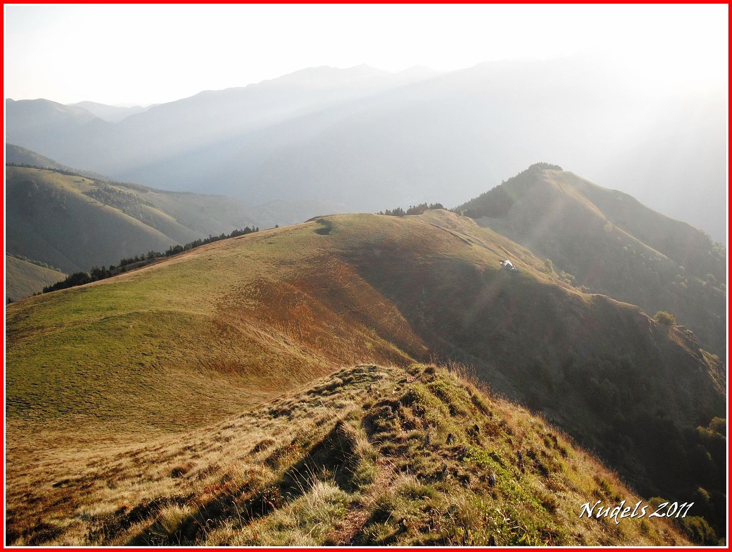
11h10: Por esa escarpada cresta sigue el cordal fronterizo, nosotros lo dejaremos aquí y regresaramos al vehículo.

11h10: El Pic du Gar, Saillant y a la derecha el Cagire.

11h10: Ya lo decía antes las vistas son preciosas.

11h11: Ya lo decía antes las vistas son preciosas.

11h14: La parte francesa.

11h14:

11h18: Regresamos pero ahora vamos a bordear al Vacanera por su cara E.

11h26:

11h32: Vamos por el camino marcado por el ganado.

11h45: Mucha gente sube de Francia al Vacanera, saludamos a unos holandeses.

12h00: Y bajamos por "lo tieso" y acortar un poco la ruta.

12h27: Pero antes de llegar al vehículo vamos a visitar la Cabaña Serralonga.

12h29:

12h30: Hacemos algunas fotografías.

12h31:

12h35: Y cuando finalizamos vamos en busca del 4x4.

12h48: Y finalmente con vistas al Tuc deth Plan deth Home o Tuc de Vacanera, querido/a lector/a te decimos...

12h48: 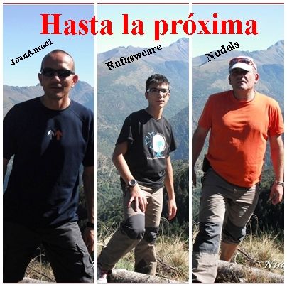
Datos obtenidos de MapSource.


6 comentarios:
Menudo paquete de mugas que os habéis echado al zurrón! y encima con figurantes de lujo, así ya se puede, jaja
Un saludo
Aupa Paco.Te digo lo mismo que Luis,vaya paquete de mugas,lo que me gustaría hacer ese recorrido pero me pilla muy lejos.Esta semana pasada he estado con mi mujer en Andalucía y no he hecho montaña,mañana sí.Que sigas disfrutando.
Un saludo.
Luis:
Si, pasando por zona de mugas no podemos dejar pasar la oportunidad.
Xabier:
Pues cuando gestiones el tiempo cuenta conmigo para subir por estas montañas y también para las cervezas.
Gracias a los dos por la visita.
Bon dia,
sisplau, em podries dir si la pista de pujada que vau fer amb el 4x4 és viable fer-la en BTT? El ferm d'aquesta pista està bé? O està molt descompost?
Moltes gràcies,
David
Hola David:
La pista forestal se puede hacer con BTT, faltaría más sino para qué están esas máquinas. Puede que el rigor del invierno haya dejado alguna canaleta pero sin problemas, eso sí hay tramos que la pistapica para arriba.
Gracias por la visita y que te vaya bonito con la bici.
1saludo,
moltíssimes gràcies!!!!
David
Publicar un comentario